We trust Calibro’s advice completely. Our decisions to promote land and invest in sometimes complex planning strategies often reflects their advice, which reassuringly balances the opportunities and risks, and how these risks can be addressed.

PROJECTS
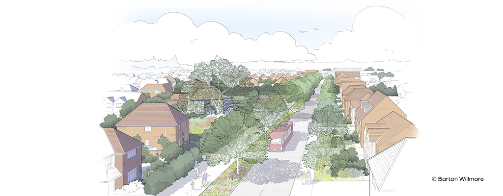
Project: Residential development of 175 dwellings (40% affordable)
Location: Markfield Road, Ratby, near Leicester
Client: Charterhouse Strategic Land Ltd
Services: Transport planning, flood risk & drainage

We were approached by Charterhouse Strategic Land during their preliminary stages of acquiring an option on a 15-acre strip of greenfield land beside the M1 Motorway at Ratby – a commuter village west of Leicester.
Drawing on the full suite of our in-house transport, flood risk assessment and drainage planning services, the client initially sought confidence that the site, tucked behind houses and gardens along Markfield Road, was viable for the development of the proposed 175 dwellings before they applied for outline planning permission. Following these preliminary studies, Calibro were tasked with preparing a suite of robust evidence to support an outline planning application.
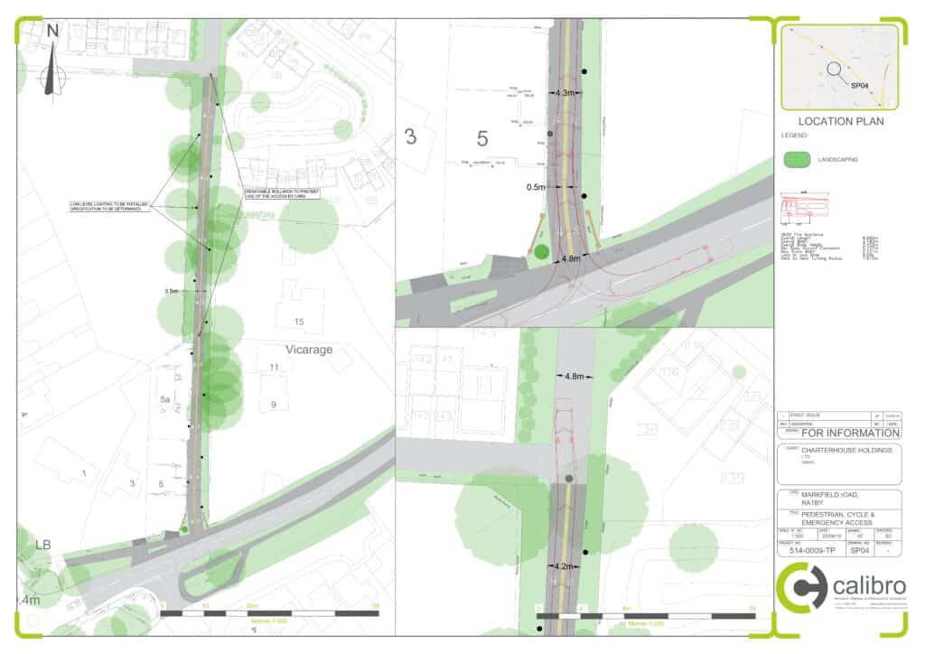
The site was long and thin, and existing vehicular access was limited to a single track lane in one corner of the site from a substandard junction onto the main road through the village. A strip of land halfway up Markfield Road offered alternative access, but the properties either side restricted visibility in both directions. If not addressed, the highway safety impacts could have been deemed ‘unacceptable’ (a broad benchmark), rendering the scheme unviable.
Although outline planning permission does not require such detail, we set up to de-risk and add value at every opportunity. To facilitate the sale of the site to a developer (Miller Homes in this case), we helped Charterhouse by partially discharging the planning condition relating to the traffic calming. We carried out a detailed design and costing exercise to give the purchaser confidence.
We visited the site within 24-hours of the client’s request and subsequently instigated speed surveys on Markfield Road so we could produce evidence-based models and designs. The model showed that moving the kerb forward by just 50cm would enable sufficient visibility to be , to standard. To provide further confidence to the process, we submitted our design to the Highway Authority for pre-application comments, resulting in their in-principle approval.
By effectively narrowing the road at the turning, we were also calming the traffic flow and creating a more pedestrian-friendly environment. We showed how the existing access road could be retained within the masterplan as an emergency access route, with removable bollards; upgrading the lane to a footpath/cycleway, with trees and lighting; and facilitating a safer, shorter journey to the local school. Rather than planning for cars, with an eye on sustainability we focused on pedestrians and providing community benefit.
As part of the transport assessment and travel plan we also looked at the impact of the development on local junctions. We found these were already nearing capacity, exacerbated by the use of adjacent roads as cut-throughs if there were problems on the M1 Motorway. However, our modelling was able to convince the authority that the cumulative effect of the proposed development on the road capacity was minimal, adding just seconds to journey times.
We engaged fully with vocal local residents at public consultation events, enabling residents to make up their own minds. As well as traffic calming on Markfield Road, our proposals provided a new signalised crossing to improve safety for existing school children on their walk to school.

We trust Calibro’s advice completely. Our decisions to promote land and invest in sometimes complex planning strategies often reflects their advice, which reassuringly balances the opportunities and risks, and how these risks can be addressed.